GAL Terre dell'Etna
e dell'Alcantara
Reading the past to build the future. Local Development Plan for the 26 municipalities of the partnership.
LAG / LEADER
26
175,278
965.52 km²
Development Plan for the Partnership Municipalities
GAL Terre dell'Etna e dell'Alcantara S.c.c.a.r.l. is a Local Action Group operating within the LEADER intervention of the Sicily PSP, promoting integrated local development in an extraordinary territory: the eastern slopes of Etna, the Alcantara Valley, and the coastline from Giardini Naxos to Riposto.
The Lean & Quality Solutions Lab was commissioned to prepare the Local Development Plan (PSL) under Operational Project No. 1/2023, approved by Board Resolution No. 142 of December 30, 2023, entitled "Project for the Future of the Etna and Alcantara Lands".
The project produced a multilevel scientific territorial study involving all 26 municipalities of the partnership, with an in-depth analysis of the environmental, socioeconomic, historical-cultural, and infrastructural context.
The Plan outlines a comprehensive, broad, and unified vision for territorial development in the medium-long term, defining growth hypotheses unified in a shared strategic design. It identifies intervention lines, actions, and projects, establishing a scale of priorities.
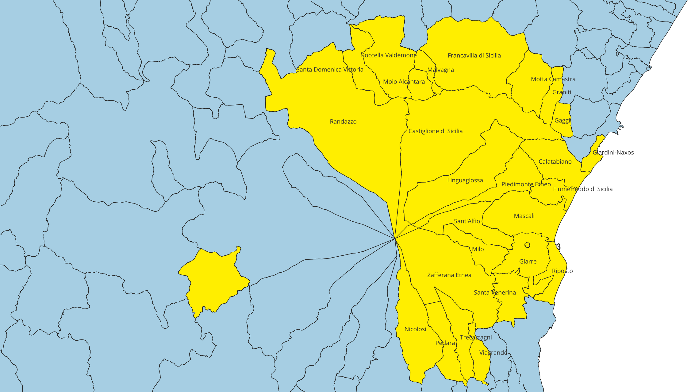
The 26 partnership municipalities of GAL Terre dell'Etna e dell'Alcantara, across the provinces of Catania and Messina.
A unique heritage between volcano and river
The GAL territory covers 965.52 km² on the eastern side of Sicily, with a predominantly mountainous-hilly terrain. It encompasses the entire Alcantara River hydrographic basin and the North, East, and South slopes of Mount Etna, Europe's tallest active volcano.
The area hosts an exceptional natural heritage: 3 Regional Parks (Etna Park, Nebrodi Mountains Park, Alcantara River Park), 2 Nature Reserves, and 22 SCI and SPA sites, covering 46,460 hectares of protected surface (48% of total territory).
The four territorial zones
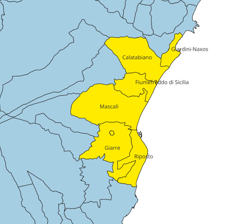
Coastal Zone
From Giardini Naxos to Riposto. Tourism, port infrastructure, citrus farming.
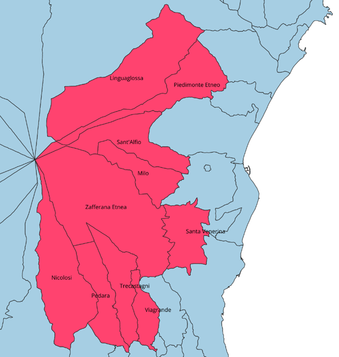
Foothill Zone
Giarre, Mascali, Piedimonte Etneo. Viticulture, citrus farming, urban centers.
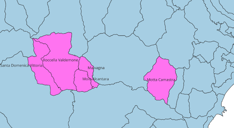
Alcantara Valley
Francavilla, Castiglione, Randazzo. River Park, historic villages, food & wine.
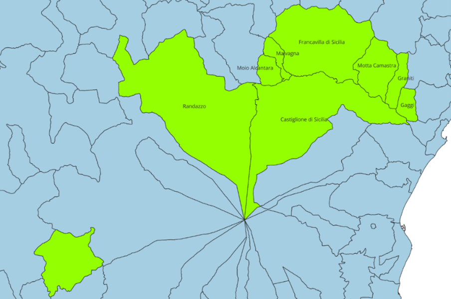
Mountain Zone
Etna and Nebrodi slopes. Natural parks, hiking, biodiversity.
Province of Catania (17)
Calatabiano, Castiglione di Sicilia, Fiumefreddo di Sicilia, Giarre, Linguaglossa, Mascali, Milo, Nicolosi, Pedara, Piedimonte Etneo, Randazzo, Riposto, Sant'Alfio, Santa Venerina, Trecastagni, Viagrande, Zafferana Etnea
Province of Messina (9)
Francavilla di Sicilia, Gaggi, Giardini-Naxos, Graniti, Malvagna, Moio Alcantara, Motta Camastra, Roccella Valdemone, Santa Domenica Vittoria
Multilevel scientific approach
The study adopts a rigorous territorial analysis methodology structured in four complementary dimensions, aligned with international sustainable development frameworks (Agenda 2030, European Green Deal, CAP 2023-2027).
Territory & Environment
Urban planning, transport infrastructure, historic architecture, mapping of abandoned villages, protected areas census, biodiversity assessment.
Productive Fabric
Complete enterprise census by sector (agriculture, industry, services), with tourism deep-dive: accommodation capacity, tourist services by category.
Socioeconomic Framework
Economic analysis through labor market and business indicators. Population study through demographic and socioeconomic indices. Territory mapping by Local Labour Systems.
History & Traditions
Historical economic and social evolution of the Etna and Alcantara territories. Focus on ancient crafts and traditions, analysis of place identity.
Accommodation infrastructure
The tourism analysis mapped the distribution and capacity of accommodation facilities in each municipality.
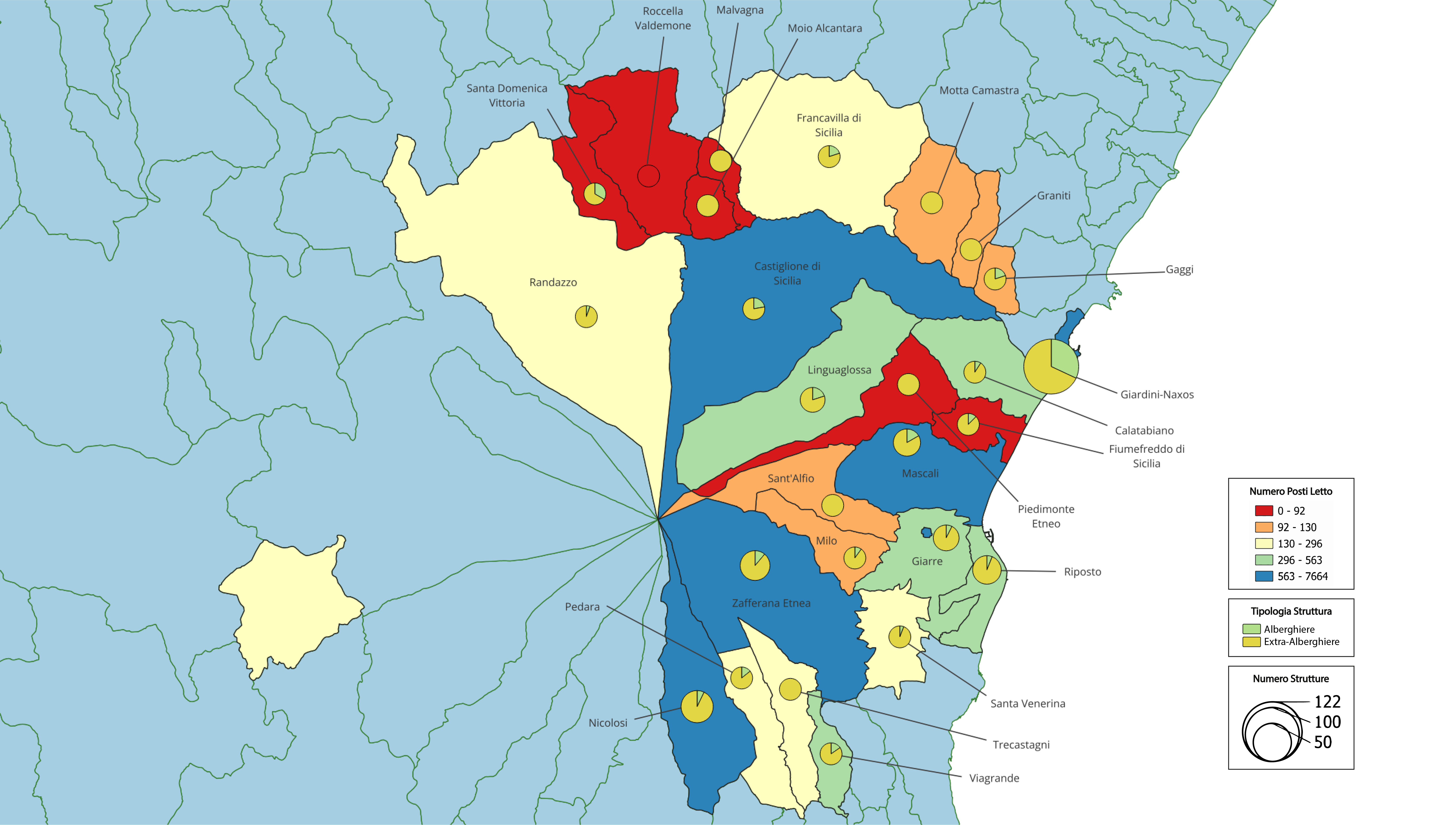
Bed capacity and facility types for each GAL municipality.
Excellence supply chains and infrastructure
The GAL territory hosts internationally renowned agri-food supply chains. Etna viticulture, with 144 wineries across certified contrade, represents a globally unique case of "heroic" viticulture on volcanic soils.
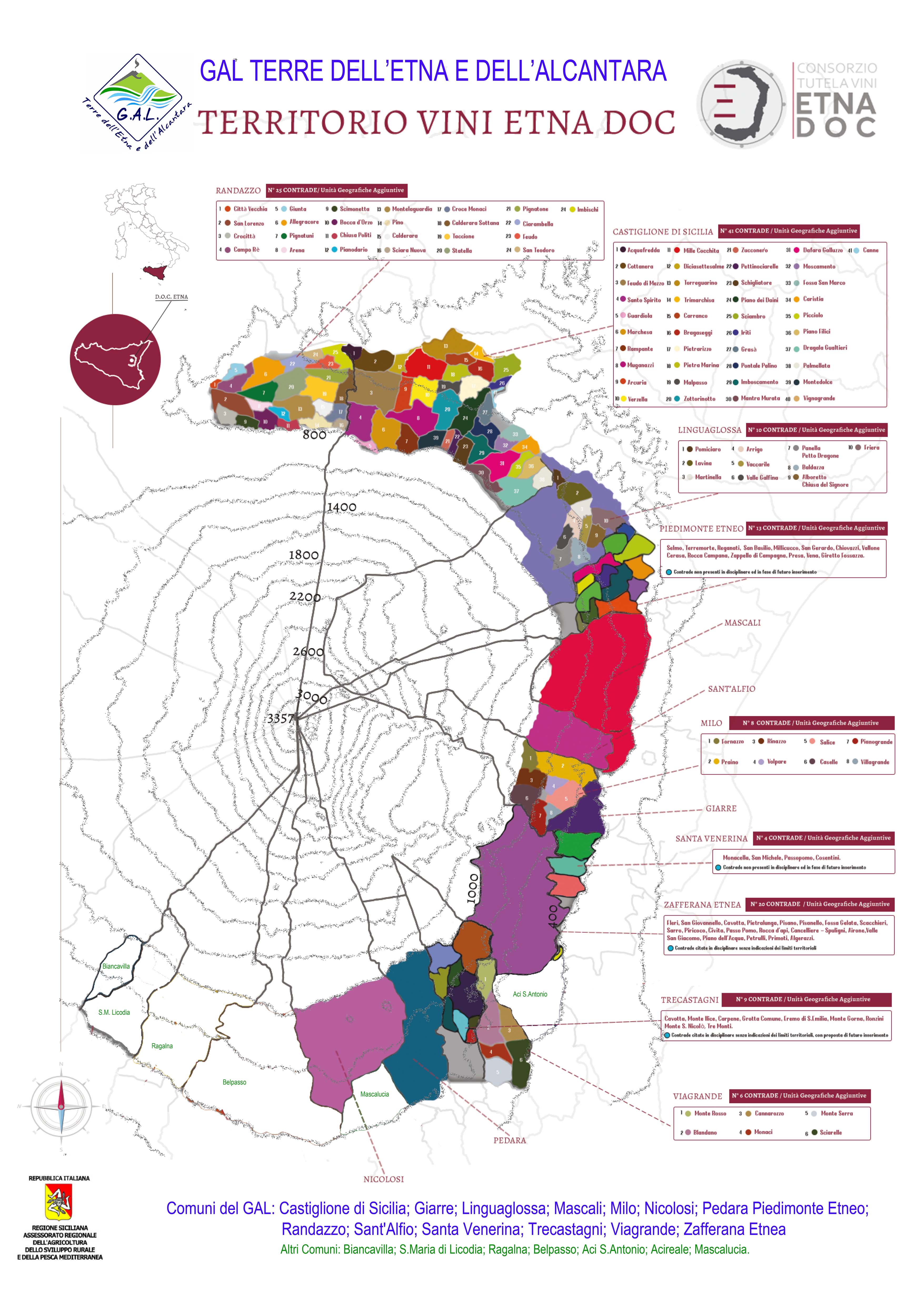
Etna DOC Wines
Certified Contrade and Additional Geographic Units. Volcanic terroir producing internationally recognized wines.
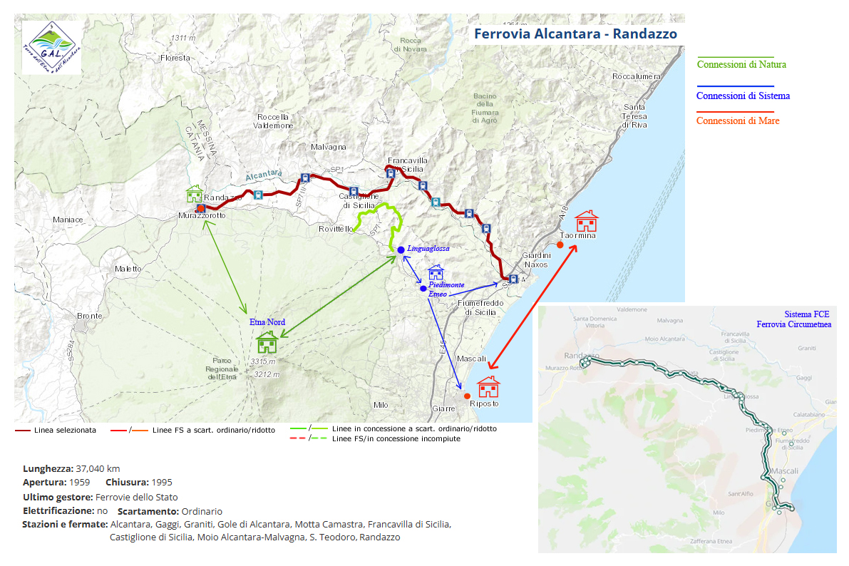
Alcantara-Randazzo Railway
Historic line (1959-1995, 37 km) with potential for cycling greenway conversion.
Research products
Scientific Territorial Study
Report on the State of the Territorial System.
Strategic Plan
Reading the past to build the future.
Interactive Report
Navigable web dashboard with data and indicators for each municipality.
Summary Document
Operational summary for policymakers and stakeholders.
Position Paper
Scientific recommendations based on comparative analysis with neighboring LAGs.
Public Presentation
Results presented to GAL partnership (May 15, 2025).
Community-Led Local Development Strategy
The strategy is structured around three fundamental axes.
Competitive territory
Local production chains enhancement, SME innovation, investment attraction, service digitalization.
Sustainable territory
UNESCO Etna heritage protection, ecological transition, circular economy, sustainable water management.
Liveable territory
Quality of life, countering depopulation, abandoned village regeneration, sustainable mobility.
Working group
Scientific coordination
- Coord. Prof. Giuseppe Ioppolo
- Prof. Michele Limosani
- Prof. Giuseppe Caristi
- Prof. Roberta Arbolino
- Prof. Katarzyna Szopik-Depczyńska
Researchers
- Dr. Carlotta D'Alessandro
- Dr. Pietro Di Pietro
- Dr. Andrea Morana